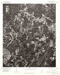
1975 Map of Yolande NE
USGS Topo · Published 1977About this map
Hueytown and the nearby community of Virginia are the primary focal points of this mid-1970s orthophotoquad, which uses aerial photography to document the evolving landscape of Jefferson County. The high-contrast imagery reveals a complex mix of industrial activity and residential expansion, particularly visible in the sprawling clearings and excavation sites that punctuate the wooded hills. The course of Valley Creek winds through the lower portion of the sheet, providing a natural reference point amidst the geometric patterns of modern road networks and land development. This specific survey, produced by the Geological Survey in cooperation with the Soil Conservation Service, offers a distinct visual record of the region’s topography before the intensifying suburbanization of the late 20th century, making it a valuable resource for tracing property boundaries and land use changes in the Birmingham area.
Find a feature on this map
3 named features on this map. Tap any name to fly to it.
Don’t see what you’re looking for? This feature index may not catch every label — zoom into the map to look around manually.
Map Details
Editions of this 1975 Yolande NE Map
This is the sole edition of this map. No revisions or reprints were ever made.
Other maps of this area

1889 · Birmingham
USGS Topo · 1:125,000

1890 · Bessemer
USGS Topo · 1:125,000

1892 · Birmingham
USGS Topo · 1:125,000

1892 · Bessemer
USGS Topo · 1:125,000

1893 · Jasper
USGS Topo · 1:125,000

1895 · Birmingham
USGS Topo · 1:125,000

1899 · Brookwood
USGS Topo · 1:125,000

1904 · Birmingham Coal District
USGS Topo · 1:62,500

1905 · Bessemer Iron District
USGS Topo · 1:62,500

1906 · Birmingham Special
USGS Topo · 1:62,500