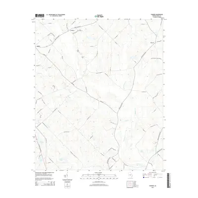
2014 Map of Yonkers
USGS Topo · Published 2014About this map
Yonkers and the surrounding agricultural lands of Dodge County appear as a network of rural routes and family landmarks in this 2014 topographic survey. The area is defined by the headwaters and meandering courses of Walton Cr, Gum Swamp Cr, and Little Gum Swamp Cr, which drain the low-lying terrain. Local genealogy is well-documented through numerous family-named burial grounds, including Rogers Cemetery, Douglas Cem, Darsey Cem, and Lister Cem.
Find a feature on this map
76 named features on this map. Tap any name to fly to it.
Don’t see what you’re looking for? This feature index may not catch every label — zoom into the map to look around manually.
Map Details
Editions of this 2014 Yonkers Map
This is the sole edition of this map. No revisions or reprints were ever made.
Other maps of this area

1956 · Cochran
USGS Topo · 1:62,500

1957 · Macon
USGS Topo · 1:250,000

1958 · Macon
USGS Topo · 1:250,000

1964 · Macon
USGS Topo · 1:250,000

1972 · Eastman
USGS Topo · 1:24,000

1972 · West Of Eastman
USGS Topo · 1:24,000

1972 · Jay Bird Springs
USGS Topo · 1:24,000

1973 · Cadwell
USGS Topo · 1:24,000

1974 · Chester
USGS Topo · 1:24,000
1974 · Yonkers
USGS Topo · 1:24,000