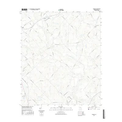
2017 Map of Yonkers
USGS Topo · Published 2017About this map
Yonkers and Roddy anchor this rural landscape in Dodge County, where the terrain is defined by a complex network of wetlands and drainage basins. The area is heavily intersected by Gum Swamp Creek and its various tributaries, including Little Gum Swamp Creek and Walton Cr. This low-lying hydrology is further emphasized by several still-water features such as Milton Tripp Lake, Tripp Pond E, and Tripp Pond W in the southwest quadrant.
Find a feature on this map
75 named features on this map. Tap any name to fly to it.
Don’t see what you’re looking for? This feature index may not catch every label — zoom into the map to look around manually.
Map Details
Editions of this 2017 Yonkers Map
This is the sole edition of this map. No revisions or reprints were ever made.
Other maps of this area

1956 · Cochran
USGS Topo · 1:62,500

1957 · Macon
USGS Topo · 1:250,000

1958 · Macon
USGS Topo · 1:250,000

1964 · Macon
USGS Topo · 1:250,000

1972 · Eastman
USGS Topo · 1:24,000

1972 · West Of Eastman
USGS Topo · 1:24,000

1972 · Jay Bird Springs
USGS Topo · 1:24,000

1973 · Cadwell
USGS Topo · 1:24,000

1974 · Chester
USGS Topo · 1:24,000
1974 · Yonkers
USGS Topo · 1:24,000