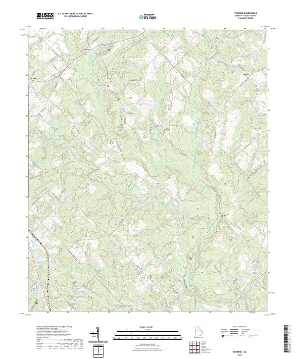
2024 Map of Yonkers
USGS Topo · Published 2024About this map
Yonkers and Roddy define the rural character of this Dodge County landscape, where small agricultural settlements and family-named landmarks are connected by a network of local roads like Roddy Hwy and Eastman-Chester Hwy. The terrain is shaped by the winding paths of Walton Creek and the broader basin of Gum Swamp Creek, with numerous small water bodies including Milton Tripp Lake and Long Pond dotting the low-lying areas. Genealogists will find significant value in the placement of small, rural burial grounds such as Rogers Darsey Cem, Douglas Cem, and Lister Cem, which remain as persistent anchors of local history amidst the timber and farmlands. The map reveals a persistent settlement pattern where old routes like Old Yonkers Rd and Macedonia Church Rd continue to serve as the primary links between these longstanding community centers.
Find a feature on this map
74 named features on this map. Tap any name to fly to it.
Don’t see what you’re looking for? This feature index may not catch every label — zoom into the map to look around manually.
Map Details
Editions of this 2024 Yonkers Map
This is the sole edition of this map. No revisions or reprints were ever made.
Other maps of this area

1956 · Cochran
USGS Topo · 1:62,500

1957 · Macon
USGS Topo · 1:250,000

1958 · Macon
USGS Topo · 1:250,000

1964 · Macon
USGS Topo · 1:250,000

1972 · Eastman
USGS Topo · 1:24,000

1972 · West Of Eastman
USGS Topo · 1:24,000

1972 · Jay Bird Springs
USGS Topo · 1:24,000

1973 · Cadwell
USGS Topo · 1:24,000

1974 · Chester
USGS Topo · 1:24,000
1974 · Yonkers
USGS Topo · 1:24,000