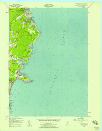
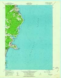
1956 Map of York Beach
USGS Topo · Published 1958About this map
Ogunquit and the York shoreline appear in this mid-century survey as a sequence of established summer colonies and working maritime coves. The map reveals the layout of the coastal landscape before modern development intensified, showing the Blue Star Memorial Highway as a primary artery while a former Railroad Grade traces the terrain inland. Notable landmarks like the Cape Neddick Lighthouse at The Nubble anchor the rocky headlands, while the intricate topography of Bald Head Cliff and Wadleighs Head defines the jagged interface between land and the Atlantic Ocean.
Find a feature on this map
65 named features on this map. Tap any name to fly to it.
Don’t see what you’re looking for? This feature index may not catch every label — zoom into the map to look around manually.
Map Details
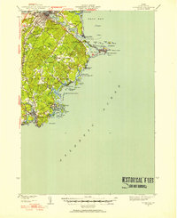
Editions of this 1956 York Beach Map
3 editions found

Other maps of this area

1891 · Biddeford
USGS Topo · 1:62,500

1891 · Kennebunk
USGS Topo · 1:62,500

1893 · Kennebunk
USGS Topo · 1:62,500

1893 · York
USGS Topo · 1:62,500

1893 · Biddeford
USGS Topo · 1:62,500

1898 · Kennebunk
USGS Topo · 1:62,500

1920 · York
USGS Topo · 1:62,500
1941 · Biddeford
USGS Topo · 1:62,500

1941 · Kennebunk
USGS Topo · 1:62,500

1944 · Wells
USGS Topo · 1:24,000