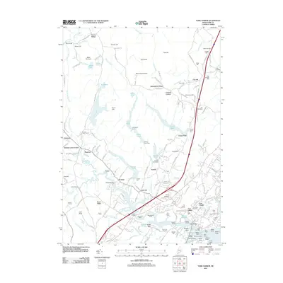
2011 Map of York Harbor
USGS Topo · Published 2011About this map
Mount Agamenticus anchors the northern high ground of this coastal landscape, looking down over a complex network of ponds and historical hamlets. The terrain transitions from the heights of Second Hill and Third Hill toward the tidal reaches of the York River. Settlement patterns are deeply rooted in the colonial past, evidenced by the Macintire Garrison and the concentration of civic life around York Village. The coastal interface is defined by rocky points and sheltered waters, from Stage Neck to the inner reaches of York Harbor.
Find a feature on this map
185 named features on this map. Tap any name to fly to it.
Don’t see what you’re looking for? This feature index may not catch every label — zoom into the map to look around manually.
Map Details
Editions of this 2011 York Harbor Map
This is the sole edition of this map. No revisions or reprints were ever made.
Other maps of this area

1891 · Berwick
USGS Topo · 1:62,500

1891 · Kennebunk
USGS Topo · 1:62,500

1893 · Kennebunk
USGS Topo · 1:62,500

1893 · Dover
USGS Topo · 1:62,500

1893 · Berwick
USGS Topo · 1:62,500

1893 · York
USGS Topo · 1:62,500

1898 · Kennebunk
USGS Topo · 1:62,500

1916 · Dover
USGS Topo · 1:62,500

1918 · Dover
USGS Topo · 1:62,500

1920 · York
USGS Topo · 1:62,500