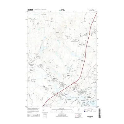
2014 Map of York Harbor
USGS Topo · Published 2014About this map
York Village and its surrounding coastal settlements anchor this study of the Maine shoreline, where historical land divisions and memorial sites are meticulously recorded. The landscape transitions from the heights of Mt Agamenticus down through several inland villages like Scotland, Cider Hill, and Agamenticus Village toward the Atlantic. A dense concentration of commemorative sites is found in the village center, including the First Parish Cem and the Revolutionary War Memorial Cem, as well as memorials for the Civil War and both World Wars.
Find a feature on this map
264 named features on this map. Tap any name to fly to it.
Don’t see what you’re looking for? This feature index may not catch every label — zoom into the map to look around manually.
Map Details
Editions of this 2014 York Harbor Map
This is the sole edition of this map. No revisions or reprints were ever made.
Other maps of this area

1891 · Berwick
USGS Topo · 1:62,500

1891 · Kennebunk
USGS Topo · 1:62,500

1893 · Kennebunk
USGS Topo · 1:62,500

1893 · Dover
USGS Topo · 1:62,500

1893 · Berwick
USGS Topo · 1:62,500

1893 · York
USGS Topo · 1:62,500

1898 · Kennebunk
USGS Topo · 1:62,500

1916 · Dover
USGS Topo · 1:62,500

1918 · Dover
USGS Topo · 1:62,500

1920 · York
USGS Topo · 1:62,500