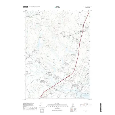
2018 Map of York Harbor
USGS Topo · Published 2018About this map
York Harbor and its surrounding coastal villages are depicted here in detail, showing a landscape defined by the winding York River and its tidal basins. The area's long maritime and colonial history is evident in the high density of memorial sites, such as the Old Burying Yard, the Revolutionary War Memorial Cem, and the Vietnam War Memorial Cem near the town center. Moving inland from the coast at York Beach, the terrain rises toward prominent elevations like Mt Agamenticus and Second Hill, while the settlement pattern transitions to smaller inland clusters like Cider Hill and Brixham. Numerous family-named lots, such as the Brown Blaisdell Lot and Trafton Lot, are carefully noted throughout the wooded uplands. This survey documents the modern layout of these ancient communities, from the rocky shores of Rocks Nose to the inland crossings at Emerys Bridge.
Find a feature on this map
259 named features on this map. Tap any name to fly to it.
Don’t see what you’re looking for? This feature index may not catch every label — zoom into the map to look around manually.
Map Details
Editions of this 2018 York Harbor Map
This is the sole edition of this map. No revisions or reprints were ever made.
Other maps of this area

1891 · Berwick
USGS Topo · 1:62,500

1891 · Kennebunk
USGS Topo · 1:62,500

1893 · Kennebunk
USGS Topo · 1:62,500

1893 · Dover
USGS Topo · 1:62,500

1893 · Berwick
USGS Topo · 1:62,500

1893 · York
USGS Topo · 1:62,500

1898 · Kennebunk
USGS Topo · 1:62,500

1916 · Dover
USGS Topo · 1:62,500

1918 · Dover
USGS Topo · 1:62,500

1920 · York
USGS Topo · 1:62,500