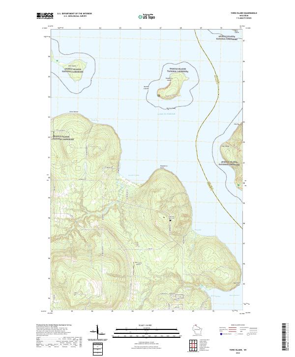
2022 Map of York Island
USGS Topo · Published 2022About this map
Lake Superior dominates this northern reach of the Apostle Islands National Lakeshore, where the coastline of Bayfield County breaks into a series of distinctive points and islands. The terrain is defined by the proximity of York Island, Raspberry Island, and the western edge of Oak Island, which sit offshore from Point Detour. Inland, the landscape is marked by the Raspberry River and Frog Creek, which drain into their respective bays. A small local landmark, the Ishpiming Akin Cemetery, sits near Blueberry Road, providing a rare genealogical anchor in this primarily conservation-focused area. The presence of Petit Cache Airport and the Marina-Shoal off Raspberry Island indicates the area's continued reliance on air and water access. The road network, including County Highway K and Peterson Hill Road, provides modern access to the shoreline at Raspberry Bay and Red Cliff Bay.
Find a feature on this map
48 named features on this map. Tap any name to fly to it.
Don’t see what you’re looking for? This feature index may not catch every label — zoom into the map to look around manually.
Map Details
Editions of this 2022 York Island Map
This is the sole edition of this map. No revisions or reprints were ever made.
Other maps of this area

1941 · Bayfield
USGS Topo · 1:48,000

1946 · Bayfield
USGS Topo · 1:48,000

1953 · Ashland
USGS Topo · 1:250,000

1954 · Two Harbors
USGS Topo · 1:250,000

1957 · Two Harbors
USGS Topo · 1:250,000

1958 · Ashland
USGS Topo · 1:250,000

1958 · Two Harbors
USGS Topo · 1:250,000

1963 · Rocky Island
USGS Topo · 1:62,500

1963 · Oak Island
USGS Topo · 1:24,000
1963 · Bear Island
USGS Topo · 1:24,000