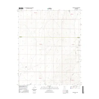
2017 Map of York Ranch SE
USGS Topo · Published 2017About this map
Veteado Draw meanders across this high-plateau landscape along the border of Cibola and Catron Counties, providing a natural corridor through the western New Mexico backcountry. The terrain is defined by its drainage systems and ranching infrastructure, such as the Elsie Tank and the rugged Goat Tank Canyon in the northeast corner. Transportation is dominated by descriptive local routes including Pie Town Rd and Trail Boss Rd, which trace the high ground and canyon rims. The presence of the Pony Express Trl and Running Mustang Lp reflects a persistent connection to historical western passage and livestock movements. These features suggest a region primarily dedicated to rangeland and limited rural access, where water sources and named canyons serve as primary landmarks for orientation in the open country.
Find a feature on this map
19 named features on this map. Tap any name to fly to it.
Don’t see what you’re looking for? This feature index may not catch every label — zoom into the map to look around manually.
Map Details
Editions of this 2017 York Ranch SE Map
This is the sole edition of this map. No revisions or reprints were ever made.
Other maps of this area

1917 · Broom Mountain
USGS Topo · 1:125,000

1954 · Saint Johns
USGS Topo · 1:250,000

1954 · Socorro
USGS Topo · 1:250,000

1957 · Saint Johns
USGS Topo · 1:250,000

1958 · Socorro
USGS Topo · 1:250,000

1958 · Saint Johns
USGS Topo · 1:250,000

1962 · Socorro
USGS Topo · 1:250,000

1962 · Saint Johns
USGS Topo · 1:250,000
1964 · Sand Canyon
USGS Topo · 1:24,000

1964 · Third Canyon
USGS Topo · 1:24,000