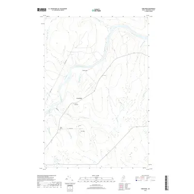
2018 Map of York Ridge
USGS Topo · Published 2018About this map
The Aroostook River winds through this northern Maine landscape, serving as the central geographic feature for the small settlement of Frenchville. This 2018 survey reveals a rural community defined by its watercourses and family legacies, with several small burial grounds such as Alley Cem and the Walker Gardiner Cem scattered across the terrain. These sites, along with the Frenchville Catholic Cem, offer significant points of interest for genealogists tracing early families in the region.
Find a feature on this map
21 named features on this map. Tap any name to fly to it.
Don’t see what you’re looking for? This feature index may not catch every label — zoom into the map to look around manually.
Map Details
Editions of this 2018 York Ridge Map
This is the sole edition of this map. No revisions or reprints were ever made.
Other maps of this area

1929 · Portage
USGS Topo · 1:62,500

1929 · Caribou
USGS Topo · 1:48,000

1931 · Ashland
USGS Topo · 1:48,000

1931 · Portage
USGS Topo · 1:62,500

1932 · Caribou
USGS Topo · 1:62,500

1934 · Ashland
USGS Topo · 1:62,500

1935 · Presque Isle
USGS Topo · 1:62,500

1953 · Ashland
USGS Topo · 1:62,500

1953 · Portage
USGS Topo · 1:62,500

1953 · Presque Isle
USGS Topo · 1:62,500