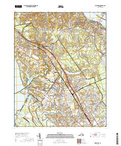
2019 Map of Yorktown
USGS Topo · Published 2019About this map
Yorktown and its storied waterfront along the York River define this coastal landscape, where the York River Cliffs meet the sandy stretch of Yorktown Beach. The area is deeply marked by a dense concentration of military and memorial sites, from the grounds of the Yorktown National Cem and the nearby Cornwallis Cave to the expansive installations at NWS Yorktown and Fort Eustis, which includes Felker Army Airfield.
Find a feature on this map
149 named features on this map. Tap any name to fly to it.
Don’t see what you’re looking for? This feature index may not catch every label — zoom into the map to look around manually.
Map Details
Editions of this 2019 Yorktown Map
This is the sole edition of this map. No revisions or reprints were ever made.
Other maps of this area

1906 · Williamsburg
USGS Topo · 1:62,500

1907 · Yorktown
USGS Topo · 1:62,500

1907 · Hampton
USGS Topo · 1:62,500

1916 · Mathews
USGS Topo · 1:62,500

1917 · Mathews
USGS Topo · 1:62,500

1943 · Yorktown
USGS Topo · 1:62,500

1943 · Richmond
USGS Topo · 1:250,000

1944 · Yorktown
USGS Topo · 1:24,000

1944 · Morrison
USGS Topo · 1:24,000

1944 · Harris Grove
USGS Topo · 1:24,000