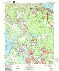
1984 Map of Yorktown
USGS Topo · Published 1984About this map
The Colonial National Historical Park preserves the complex landscape of the Yorktown siege, where the Surrender Ground and Battle Trenches remain clearly delineated among modern infrastructure. To the north, the York River separates the historic settlement from Gloucester Point, with Cornwallis Cave and the Yorktown Monument marking the riverfront. This mid-1980s landscape shows the heavy concentration of federal presence in the Virginia Peninsula, as the U S Naval Weapons Station and Fort Eustis Military Reservation flank the residential growth of Newport News City. Transportation corridors like the Colonial Parkway and the Chesapeake and Ohio railroad define the movement through this area, while local landmarks like Washingtons Headquarters and the Yorktown National Cemetery provide touchstones for genealogists and military historians studying the intersection of Revolutionary War sites and 20th-century development.
Find a feature on this map
100 named features on this map. Tap any name to fly to it.
Don’t see what you’re looking for? This feature index may not catch every label — zoom into the map to look around manually.
Map Details
Editions of this 1984 Yorktown Map
2 editions found
Other maps of this area

1906 · Williamsburg
USGS Topo · 1:62,500

1907 · Yorktown
USGS Topo · 1:62,500

1907 · Hampton
USGS Topo · 1:62,500

1916 · Mathews
USGS Topo · 1:62,500

1917 · Mathews
USGS Topo · 1:62,500

1943 · Yorktown
USGS Topo · 1:62,500

1943 · Richmond
USGS Topo · 1:250,000

1944 · Yorktown
USGS Topo · 1:24,000

1944 · Morrison
USGS Topo · 1:24,000

1944 · Harris Grove
USGS Topo · 1:24,000