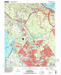
1994 Map of Yorktown
USGS Topo · Published 1999About this map
Yorktown and the surrounding Virginia Peninsula appear here as a landscape defined by significant military and commemorative sites in the mid-1990s. The northern edge follows the York River past Gloucester Point, where the Colonial National Historical Park preserves the Surrender Ground and Yorktown Monument. The presence of the Yorktown National Cemetery and Cornwallis Cave highlights the deep revolutionary history of the area.
Find a feature on this map
102 named features on this map. Tap any name to fly to it.
Don’t see what you’re looking for? This feature index may not catch every label — zoom into the map to look around manually.
Map Details
Editions of this 1994 Yorktown Map
This is the sole edition of this map. No revisions or reprints were ever made.
Other maps of this area

1906 · Williamsburg
USGS Topo · 1:62,500

1907 · Yorktown
USGS Topo · 1:62,500

1907 · Hampton
USGS Topo · 1:62,500

1916 · Mathews
USGS Topo · 1:62,500

1917 · Mathews
USGS Topo · 1:62,500

1943 · Yorktown
USGS Topo · 1:62,500

1943 · Richmond
USGS Topo · 1:250,000

1944 · Yorktown
USGS Topo · 1:24,000

1944 · Morrison
USGS Topo · 1:24,000

1944 · Harris Grove
USGS Topo · 1:24,000