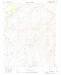
1962 Map of Yosemite Lake
USGS Topo · Published 1975About this map
The Merced River winds through the northern portion of this landscape, its banks marked by extensive Tailings that speak to the region's dredging history. This 1960s-era survey reveals a transition from the agricultural plains toward the foothills, where the Main Canal and various Lateral channels distribute water across the territory. To the south, the Yosemite Lake (County Park) serves as a primary local landmark alongside the Merced Golf Club.
Find a feature on this map
37 named features on this map. Tap any name to fly to it.
Don’t see what you’re looking for? This feature index may not catch every label — zoom into the map to look around manually.
Map Details
Editions of this 1962 Yosemite Lake Map
4 editions found
Other maps of this area

1893 · Sonora
USGS Topo · 1:125,000

1896 · Sonora
USGS Topo · 1:125,000

1897 · Sonora
USGS Topo · 1:125,000

1898 · Sonora
USGS Topo · 1:125,000

1913 · Dickenson
USGS Topo · 1:31,680

1914 · Merced
USGS Topo · 1:31,680

1916 · Three Tree Flat
USGS Topo · 1:31,680

1916 · Hopeton
USGS Topo · 1:31,680

1916 · Merced Falls
USGS Topo · 1:24,000

1917 · Winton
USGS Topo · 1:31,680