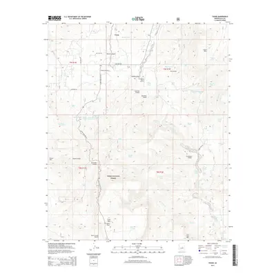
2014 Map of Young
USGS Topo · Published 2014About this map
The isolated settlement of Young and the surrounding Pleasant Valley are documented here within the expanse of the Tonto National Forest. This high-country landscape is defined by its ranching and frontier character, evidenced by numerous water features such as Mexican Tank and the Vosburg Trick Tank. Local history is anchored at the Perkins Museum, while transportation through the canyons is facilitated by the Globe-Young Hwy Scn and the historic Mail Trail Rd. Significant relief is provided by Bryant Mtn and Squaw Peak, with the drainage of Cherry Creek carving through the center of the sheet. The map reveals the intricate network of canyons including Graveyard Canyon and Sevenmile Canyon, illustrating the topographical challenges and natural resources that have shaped this Gila County community for generations.
Find a feature on this map
66 named features on this map. Tap any name to fly to it.
Don’t see what you’re looking for? This feature index may not catch every label — zoom into the map to look around manually.
Map Details
Editions of this 2014 Young Map
This is the sole edition of this map. No revisions or reprints were ever made.
Other maps of this area

1886 · Holbrook
USGS Topo · 1:250,000

1887 · Verde
USGS Topo · 1:250,000

1892 · Verde
USGS Topo · 1:250,000

1893 · Holbrook
USGS Topo · 1:250,000

1907 · Roosevelt
USGS Topo · 1:125,000

1909 · Four Peaks
USGS Topo · 1:125,000

1912 · Roosevelt
USGS Topo · 1:125,000

1922 · Chrysotile
USGS Topo · 1:125,000

1937 · Diamond Butte
USGS Topo · 1:48,000

1943 · Diamond Butte
USGS Topo · 1:62,500