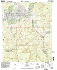
2004 Map of Young
USGS Topo · Published 2006About this map
Pleasant Valley and the settlement of Young serve as the focal points of this high-elevation basin within the Tonto National Forest. The landscape is a complex network of drainages and mesas, where livestock management and water access are central to the local economy, evidenced by numerous tanks and springs like Hog Canyon Tank and Scarlet Spring. Significant infrastructure supports the community, including the Pleasant Valley Sch and a system of levees protecting the valley floor from seasonal runoff. Historically, the area is defined by its isolation and topographical boundaries, such as Squaw Mesa and Cow Flat Mountain. The map details transition points like the Transfer Station and a Gravel Pit, alongside land markers like the local Cem and an isolated Grave, reflecting the sparse but enduring human presence in this Gila County interior.
Find a feature on this map
55 named features on this map. Tap any name to fly to it.
Don’t see what you’re looking for? This feature index may not catch every label — zoom into the map to look around manually.
Map Details
Editions of this 2004 Young Map
This is the sole edition of this map. No revisions or reprints were ever made.
Other maps of this area

1886 · Holbrook
USGS Topo · 1:250,000

1887 · Verde
USGS Topo · 1:250,000

1892 · Verde
USGS Topo · 1:250,000

1893 · Holbrook
USGS Topo · 1:250,000

1907 · Roosevelt
USGS Topo · 1:125,000

1909 · Four Peaks
USGS Topo · 1:125,000

1912 · Roosevelt
USGS Topo · 1:125,000

1922 · Chrysotile
USGS Topo · 1:125,000

1937 · Diamond Butte
USGS Topo · 1:48,000

1943 · Diamond Butte
USGS Topo · 1:62,500