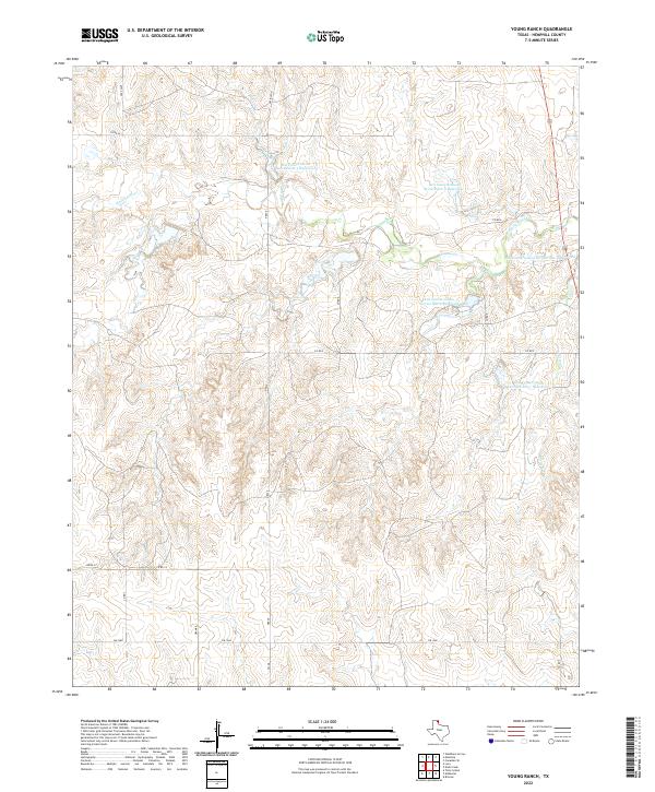
2022 Map of Young Ranch
USGS Topo · Published 2022About this map
The Washita River winds through this section of Hemphill County, defining a landscape shaped by mid-century water management efforts. Numerous reservoirs, including Soil Conservation Service Site 3 Reservoir and Soil Conservation Service Site 6 Reservoir, dot the terrain north of FM 1268, reflecting the region's focus on soil conservation and flood control. Industrial infrastructure is visible in the northwest corner with the presence of a Gas Plant near Co RD W. The area is otherwise characterized by a network of rural routes such as FM 48 and Creek CC, which provide access to the various drainage basins and the eastern waters of White Cr.
Find a feature on this map
19 named features on this map. Tap any name to fly to it.
Don’t see what you’re looking for? This feature index may not catch every label — zoom into the map to look around manually.
Map Details
Editions of this 2022 Young Ranch Map
This is the sole edition of this map. No revisions or reprints were ever made.
Other maps of this area

1954 · Amarillo
USGS Topo · 1:250,000

1958 · Amarillo
USGS Topo · 1:250,000

1963 · Briscoe
USGS Topo · 1:24,000

1963 · Mobeetie
USGS Topo · 1:24,000

1967 · Mendota
USGS Topo · 1:24,000

1967 · Dads Creek
USGS Topo · 1:24,000

1967 · Young Ranch
USGS Topo · 1:24,000

1967 · Tody School
USGS Topo · 1:24,000

1967 · Canadian SE
USGS Topo · 1:24,000

1967 · Lora
USGS Topo · 1:24,000