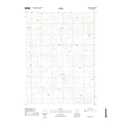
2017 Map of Young Valley
USGS Topo · Published 2017About this map
Young Valley and its surrounding Nebraska Sandhills are defined by an intricate network of interconnected depressions and ephemeral wetlands within the High Plains. This 2017 survey shows a landscape where nomenclature is tied deeply to family names and descriptive terrain, such as Lost Bull Valley and Black Steer Valley. The few named water bodies, notably Britton Lake, suggest the critical importance of surface water in this arid environment.
Find a feature on this map
27 named features on this map. Tap any name to fly to it.
Don’t see what you’re looking for? This feature index may not catch every label — zoom into the map to look around manually.
Map Details
Editions of this 2017 Young Valley Map
This is the sole edition of this map. No revisions or reprints were ever made.
Other maps of this area

1949 · Mumper
USGS Topo · 1:62,500

1949 · Rackett
USGS Topo · 1:62,500

1950 · Crescent Lake
USGS Topo · 1:62,500

1950 · Longfellow Lake
USGS Topo · 1:62,500

1951 · Rackett
USGS Topo · 1:62,500

1954 · Scottsbluff
USGS Topo · 1:250,000

1958 · Scottsbluff
USGS Topo · 1:250,000

1985 · Crescent Lake
USGS Topo · 1:100,000
1986 · McCarty Lake
USGS Topo · 1:24,000
1986 · Hessey Lake
USGS Topo · 1:24,000