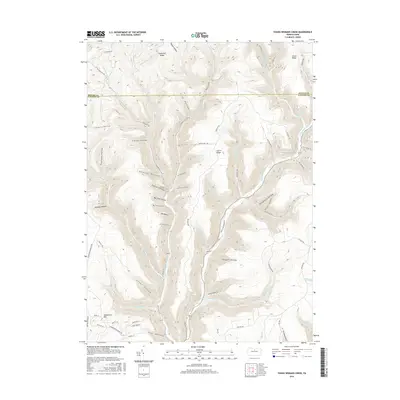
2016 Map of Young Womans Creek
USGS Topo · Published 2016About this map
Summerson Mtn anchors the southwestern corner of this deeply dissected landscape, where the boundary between Potter County and Clinton County cuts through a complex network of high ridges and named hollows. The drainage system is dominated by the Young Womans Cr and its significant tributaries, including the Left Br Young Womans Cr and Laurel Fork. The map reveals a transition from the broad, flat-topped elevations of Greenlick Ridge and Laurel Ridge to the narrow, steep-walled drainages like Calamity Hollow and Ingram Hollow. An intricate web of forestry and access routes such as Fork Hill Rd, Twelve Mile Rd, and the Shingle Mill Trl indicates a region deeply tied to timber management and outdoor recreation, while residential clusters near Mink Ln and Cherry Ln mark the limited areas of contemporary settlement.
Find a feature on this map
68 named features on this map. Tap any name to fly to it.
Don’t see what you’re looking for? This feature index may not catch every label — zoom into the map to look around manually.
Map Details
Editions of this 2016 Young Womans Creek Map
This is the sole edition of this map. No revisions or reprints were ever made.
Other maps of this area

1943 · Hyner
USGS Topo · 1:62,500

1946 · Young Womans Creek
USGS Topo · 1:24,000

1946 · Renovo East
USGS Topo · 1:62,500

1946 · Renovo West
USGS Topo · 1:62,500

1946 · Tamarack
USGS Topo · 1:24,000

1946 · Slate Run
USGS Topo · 1:24,000

1946 · Renovo East
USGS Topo · 1:24,000

1946 · Renovo West
USGS Topo · 1:24,000

1946 · Glen Union
USGS Topo · 1:24,000

1947 · Conrad
USGS Topo · 1:62,500