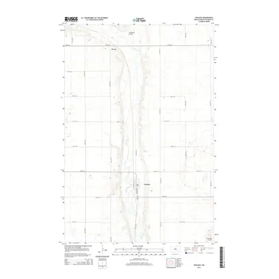
2014 Map of Ypsilanti
USGS Topo · Published 2014About this map
The James River winds through the heart of this North Dakota landscape, carving a distinct valley through the prairie of Stutsman County. At the center of the survey lies Ypsilanti, a small community defined by its grid of streets and the presence of a local Po. The settlement pattern here is dictated by the river’s path and the sectional road system, with north-south routes like 90th Ave SE providing access to the fertile valley floor.
Find a feature on this map
22 named features on this map. Tap any name to fly to it.
Don’t see what you’re looking for? This feature index may not catch every label — zoom into the map to look around manually.
Map Details
Editions of this 2014 Ypsilanti Map
This is the sole edition of this map. No revisions or reprints were ever made.
Other maps of this area

1896 · Jamestown
USGS Topo · 1:125,000

1897 · Eckelson
USGS Topo · 1:125,000

1951 · Jamestown
USGS Topo · 1:24,000

1952 · Homer
USGS Topo · 1:24,000

1952 · Ypsilanti
USGS Topo · 1:24,000

1952 · Bloom
USGS Topo · 1:24,000

1953 · Jamestown
USGS Topo · 1:250,000

1953 · Montpelier
USGS Topo · 1:24,000

1953 · Montpelier NW
USGS Topo · 1:24,000

1956 · Jamestown
USGS Topo · 1:250,000