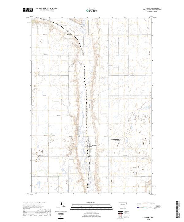
2024 Map of Ypsilanti
USGS Topo · Published 2024About this map
The James River snakes through the center of this North Dakota landscape, carving a prominent valley through the prairie of Stutsman County. At the heart of this region sits the settlement of Ypsilanti, situated at the intersection of Co Hwy 63 and Co Hwy 38. This modern survey reveals the persistent grid of section lines and rural roads, such as 44th St SE and 90th Ave SE, which define the agricultural character of the plains. Along the river's western banks, Sevenmile Coulee provides a natural drainage feature, while to the north, the small community of Reeves occupies the higher ground. Local history is anchored by the Valley Cem just south of the main town and the presence of Sperr Airport to the east, illustrating the blend of traditional land use and small-scale regional infrastructure.
Find a feature on this map
28 named features on this map. Tap any name to fly to it.
Don’t see what you’re looking for? This feature index may not catch every label — zoom into the map to look around manually.
Map Details
Editions of this 2024 Ypsilanti Map
This is the sole edition of this map. No revisions or reprints were ever made.
Other maps of this area

1896 · Jamestown
USGS Topo · 1:125,000

1897 · Eckelson
USGS Topo · 1:125,000

1951 · Jamestown
USGS Topo · 1:24,000

1952 · Homer
USGS Topo · 1:24,000

1952 · Ypsilanti
USGS Topo · 1:24,000

1952 · Bloom
USGS Topo · 1:24,000

1953 · Jamestown
USGS Topo · 1:250,000

1953 · Montpelier
USGS Topo · 1:24,000

1953 · Montpelier NW
USGS Topo · 1:24,000

1956 · Jamestown
USGS Topo · 1:250,000