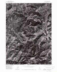
1974 Map of Yreka NW
USGS Topo · Published 1980About this map
The northern edge of Yreka dominates the northeastern corner of this 1974 orthophotoquad, where the city’s grid meets the foothills of Siskiyou County. This aerial perspective shows the transition from urban development and the primary highway corridor to the varied terrain of the Klamath Mountains. Waterways like Yreka Creek and Moffett Creek dictate the layout of roads and agricultural clearings, while high points such as Manzanita Hill overlook the narrow valleys. Unlike traditional topographic maps, this imagery-based study reveals the exact vegetation patterns and land-use boundaries in the mid-1970s, providing a clear visual record of how the community occupied the floor of the Shasta Valley before modern expansion further altered the surrounding slopes.
Find a feature on this map
4 named features on this map. Tap any name to fly to it.
Don’t see what you’re looking for? This feature index may not catch every label — zoom into the map to look around manually.
Map Details
Editions of this 1974 Yreka NW Map
This is the sole edition of this map. No revisions or reprints were ever made.
Other maps of this area

1886 · Shasta
USGS Topo · 1:250,000

1894 · Shasta
USGS Topo · 1:250,000

1922 · Shasta Valley Sheet No 3
USGS Topo · 1:24,000

1922 · Shasta Valley Sheet No 3 S
USGS Topo · 1:24,000

1932 · Yreka
USGS Topo · 1:96,000

1939 · Yreka
USGS Topo · 1:125,000

1948 · Weed
USGS Topo · 1:250,000

1950 · Weed
USGS Topo · 1:250,000

1954 · Yreka
USGS Topo · 1:62,500

1955 · Condrey Mtn
USGS Topo · 1:62,500