
1954 Map of Yreka
USGS Topo · Published 1957About this map
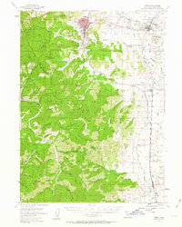
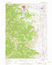
Yreka serves as the focal point for this mid-1950s survey of Northern California's Scott Valley and Shasta Valley interface. The regional transportation network is anchored by the Southern Pacific railroad, which parallels the Shasta River and connects the settlements of Montague, Grenada, and Gazelle. To the west, the foothills of the Klamath National Forest reveal a legacy of mining activity, indicated by the Pegleg Mine and Scorpion Mine near Moffett Creek. The map documents a well-distributed system of local education, including the Greenhorn School, Delphic School, and Highland School, reflecting the rural development of the era. Prominent geographical landmarks such as Bally Mountain and Antelope Mountain define the rugged verticality of the terrain, while the Pythian Cave east of Antelope Mountain suggests specific points of local geologic interest.
Find a feature on this map
68 named features on this map. Tap any name to fly to it.
Don’t see what you’re looking for? This feature index may not catch every label — zoom into the map to look around manually.
Map Details
Editions of this 1954 Yreka Map
3 editions found
Other maps of this area

1886 · Shasta
USGS Topo · 1:250,000

1894 · Shasta
USGS Topo · 1:250,000

1921 · Shasta Valley Sheet No 7
USGS Topo · 1:24,000

1921 · Shasta Valley Sheet No 1
USGS Topo · 1:24,000

1921 · Shasta Valley Sheet No 6
USGS Topo · 1:24,000

1921 · Shasta Valley Sheet No 2
USGS Topo · 1:24,000

1922 · Shasta Valley Sheet No 4
USGS Topo · 1:24,000

1922 · Shasta Valley Sheet No 1 S
USGS Topo · 1:24,000

1922 · Shasta Valley Sheet No 3
USGS Topo · 1:24,000

1922 · Shasta Valley Sheet No 3 S
USGS Topo · 1:24,000