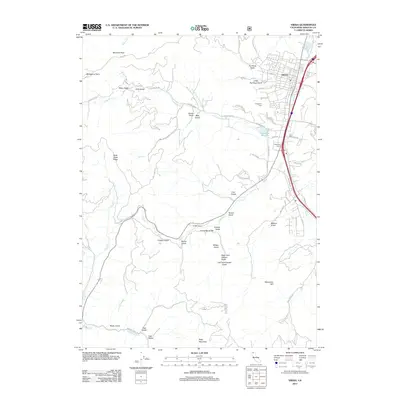
2012 Map of Yreka
USGS Topo · Published 2012About this map
Yreka serves as the central hub of this Northern California landscape, where the urban grid of streets like W Miner St and Jackson St transitions into a complex network of gulches and ridges. The settlement pattern reflects a long history of water management and land use, anchored by the Greenhorn Reservoir and educational sites like Greenhorn School. To the south, Forest House stands as a notable landmark along the winding path of Yreka Cr.
Find a feature on this map
60 named features on this map. Tap any name to fly to it.
Don’t see what you’re looking for? This feature index may not catch every label — zoom into the map to look around manually.
Map Details
Editions of this 2012 Yreka Map
This is the sole edition of this map. No revisions or reprints were ever made.
Other maps of this area

1886 · Shasta
USGS Topo · 1:250,000

1894 · Shasta
USGS Topo · 1:250,000

1922 · Shasta Valley Sheet No 3
USGS Topo · 1:24,000

1922 · Shasta Valley Sheet No 3 S
USGS Topo · 1:24,000

1932 · Yreka
USGS Topo · 1:96,000

1939 · Yreka
USGS Topo · 1:125,000

1948 · Weed
USGS Topo · 1:250,000

1950 · Weed
USGS Topo · 1:250,000

1954 · Yreka
USGS Topo · 1:62,500

1955 · Condrey Mtn
USGS Topo · 1:62,500