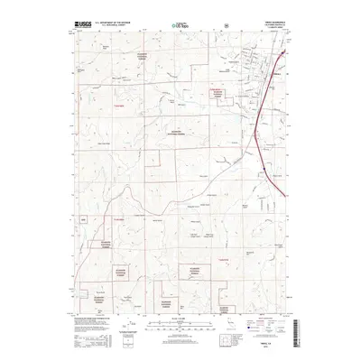
2015 Map of Yreka
USGS Topo · Published 2015About this map
The northern California settlement of Yreka serves as the focal point for this survey, where the town's residential street grid transitions into the steep, complex drainage systems of the Klamath National Forest. The landscape is defined by its deep history of water management and topography, evidenced by the Yreka Ditch winding around the northern slopes near Humbug Gulch. To the west, the massive Soap Creek Ridge and peaks like Montana Peak and Mahogany Point dominate the horizon, while the southern reaches are marked by a series of named ravines including Walters Gulch and Canaan Gulch. Local history and genealogy are anchored by the Evergreen Cemetery, situated just west of the downtown core. The map traces the rugged interface between urban development and the timbered hills, illustrating how roads like Fort Jones Rd and Greenhorn Rd follow the natural contours of the Siskiyou County terrain.
Find a feature on this map
82 named features on this map. Tap any name to fly to it.
Don’t see what you’re looking for? This feature index may not catch every label — zoom into the map to look around manually.
Map Details
Editions of this 2015 Yreka Map
This is the sole edition of this map. No revisions or reprints were ever made.
Other maps of this area

1886 · Shasta
USGS Topo · 1:250,000

1894 · Shasta
USGS Topo · 1:250,000

1922 · Shasta Valley Sheet No 3
USGS Topo · 1:24,000

1922 · Shasta Valley Sheet No 3 S
USGS Topo · 1:24,000

1932 · Yreka
USGS Topo · 1:96,000

1939 · Yreka
USGS Topo · 1:125,000

1948 · Weed
USGS Topo · 1:250,000

1950 · Weed
USGS Topo · 1:250,000

1954 · Yreka
USGS Topo · 1:62,500

1955 · Condrey Mtn
USGS Topo · 1:62,500