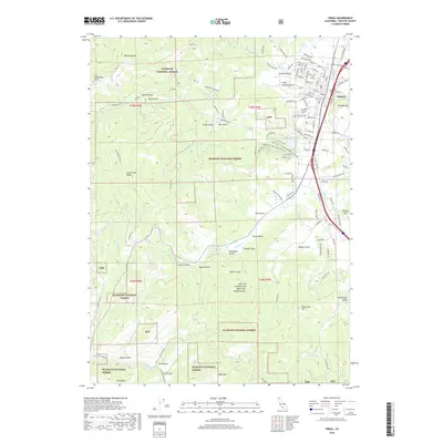
2018 Map of Yreka
USGS Topo · Published 2018About this map
Yreka sits at the eastern edge of a landscape dominated by the high peaks and deep gulches of the Klamath National Forest. This modern record reveals a town shaped by its Gold Rush origins, where historical infrastructure like the Yreka Ditch and the Greenhorn Reservoir still define the local hydrology. The surrounding terrain is a complex network of canyons and ridges, including the Kilgore Hills and Soap Creek Ridge, punctuated by family-named landmarks and historical passage points. To the west, the forest canopy covers high points like Montana Peak and Bally Mtn, while the neighborhood streets of Yreka extend toward the foot of Butcher Hill. The map meticulously preserves the names of numerous drainage features such as Canaan Gulch and Poison Gulch, which have historically dictated the placement of trails and early roads like the Osgood Mine Rd and High CCC. Researchers can also locate the Evergreen Cem and trace recreation paths like the Miners Trail.
Find a feature on this map
131 named features on this map. Tap any name to fly to it.
Don’t see what you’re looking for? This feature index may not catch every label — zoom into the map to look around manually.
Map Details
Editions of this 2018 Yreka Map
This is the sole edition of this map. No revisions or reprints were ever made.
Other maps of this area

1886 · Shasta
USGS Topo · 1:250,000

1894 · Shasta
USGS Topo · 1:250,000

1922 · Shasta Valley Sheet No 3
USGS Topo · 1:24,000

1922 · Shasta Valley Sheet No 3 S
USGS Topo · 1:24,000

1932 · Yreka
USGS Topo · 1:96,000

1939 · Yreka
USGS Topo · 1:125,000

1948 · Weed
USGS Topo · 1:250,000

1950 · Weed
USGS Topo · 1:250,000

1954 · Yreka
USGS Topo · 1:62,500

1955 · Condrey Mtn
USGS Topo · 1:62,500