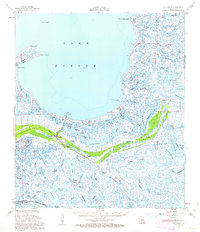
1957 Map of Yscloskey
USGS Topo · Published 1963About this map
Lake Borgne dominates the northern horizon of this coastal survey, where the marshes of eastern St. Bernard Parish meet the Gulf waters. The landscape is a complex web of lagoons and bayous, including Portman Lagoon and Hopedale Lagoon, which defined the lives of those in the small fishing and trapping communities of the mid-20th century. Settlements such as Yscloskey, Alluvial City, and Hopedale cling to the slightly higher ground along the natural levees, while the historic site of Old Fort Beauregard near Shell Beach serves as a reminder of earlier defensive positions along the coast. The mapping of Magnolia-Mound and various spoil banks indicates human intervention in this fluid environment, where navigation was guided by landmarks like the Alligator Point Light and numerous Daybeacons scattered across the inlets.
Find a feature on this map
85 named features on this map. Tap any name to fly to it.
Don’t see what you’re looking for? This feature index may not catch every label — zoom into the map to look around manually.
Map Details
Editions of this 1957 Yscloskey Map
3 editions found
Other maps of this area

1891 · Pointe a La Hache
USGS Topo · 1:62,500

1892 · Chef Menteur
USGS Topo · 1:62,500

1892 · St. Bernard
USGS Topo · 1:62,500

1892 · Pointe a La Hache
USGS Topo · 1:62,500

1893 · Rigolets
USGS Topo · 1:62,500

1893 · La Fortuna
USGS Topo · 1:62,500

1893 · Shell Beach
USGS Topo · 1:62,500

1893 · Toulme
USGS Topo · 1:62,500

1893 · Dime
USGS Topo · 1:62,500

1895 · Bodreau
USGS Topo · 1:62,500