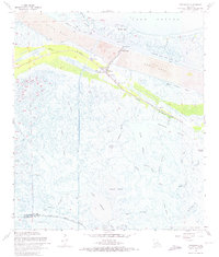
1968 Map of Yscloskey
USGS Topo · Published 1974About this map
Old Fort Beauregard Ruins stand along the southern shore of Lake Borgne, anchoring a landscape shaped by both military history and mid-century industrial expansion. This 1968 revision of the St. Bernard Parish coast reveals a transition toward a managed maritime environment, dominated by the massive Mississippi River - Gulf Outlet Canal and its surrounding spoil areas. Linear infrastructure like the New Pipeline Canal cuts through the marsh, while traditional fishing and trapping settlements like Yscloskey, Shell Beach, and Alluvial City cling to the natural levees of Bayou la Loutre. To the south, a complex network of wetlands remains largely intact, defined by the tidal reaches of Crooked Bayou, Tanasia Lagoon, and Lake Amedee. The presence of several drill holes indicates the growing petroleum interest in the parish's coastal marshes during the late 1960s.
Find a feature on this map
49 named features on this map. Tap any name to fly to it.
Don’t see what you’re looking for? This feature index may not catch every label — zoom into the map to look around manually.
Map Details
Editions of this 1968 Yscloskey Map
3 editions found
Other maps of this area

1891 · Pointe a La Hache
USGS Topo · 1:62,500

1892 · St. Bernard
USGS Topo · 1:62,500

1892 · Pointe a La Hache
USGS Topo · 1:62,500

1893 · Shell Beach
USGS Topo · 1:62,500

1893 · Dime
USGS Topo · 1:62,500

1935 · Delacroix
USGS Topo · 1:31,680

1935 · Lake Calebasse
USGS Topo · 1:31,680

1935 · Lake Batola
USGS Topo · 1:31,680

1939 · Shell Beach
USGS Topo · 1:62,500

1939 · Pointe a La Hache
USGS Topo · 1:62,500