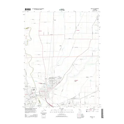
2015 Map of Yuba City
USGS Topo · Published 2015About this map
The confluence of the Feather River and Yuba River anchor this mid-2010s study of the Marysville and Yuba City area. The urban centers are linked by the Twin Cities Memorial Bridge, which spans the riverine border separating Sutter and Yuba counties. Within the city grids, distinctive landmarks such as Ellis Lake and the Sutter County Airport are clearly visible, alongside the sprawling Marysville Cemetery and Yuba City Cemetery.
Find a feature on this map
126 named features on this map. Tap any name to fly to it.
Don’t see what you’re looking for? This feature index may not catch every label — zoom into the map to look around manually.
Map Details
Editions of this 2015 Yuba City Map
This is the sole edition of this map. No revisions or reprints were ever made.
Other maps of this area

1888 · Marysville
USGS Topo · 1:125,000

1888 · Smartsville
USGS Topo · 1:125,000

1891 · Marysville
USGS Topo · 1:125,000

1891 · Smartsville
USGS Topo · 1:125,000

1892 · Smartsville
USGS Topo · 1:125,000

1894 · Smartsville
USGS Topo · 1:125,000

1894 · Marysville
USGS Topo · 1:125,000

1895 · Marysville
USGS Topo · 1:125,000

1895 · Smartsville
USGS Topo · 1:125,000

1910 · Wheatland
USGS Topo · 1:31,680