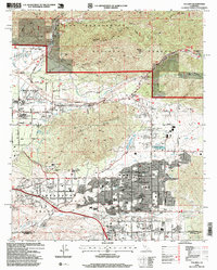
1996 Map of Yucaipa
USGS Topo · Published 1999About this map
Yucaipa and the adjacent community of Calimesa dominate the southern portion of this mid-1990s landscape, showing significant residential development organized along a dense grid of avenues and boulevards. To the north and west, the terrain rises into the Crafton Hills and the slopes of the San Bernardino National Forest, where landmarks like Cram Peak and Morton Peak overlook the Santa Ana River. The area reflects a complex water management system essential to the Inland Empire, featuring the Wilson Flood Control Basin and numerous gaging stations along Mill Creek.
Find a feature on this map
52 named features on this map. Tap any name to fly to it.
Don’t see what you’re looking for? This feature index may not catch every label — zoom into the map to look around manually.
Map Details
Editions of this 1996 Yucaipa Map
This is the sole edition of this map. No revisions or reprints were ever made.
Other maps of this area

1899 · Redlands
USGS Topo · 1:62,500

1901 · Southern California Sheet No. 1
USGS Topo · 1:250,000

1901 · San Jacinto
USGS Topo · 1:125,000

1901 · Redlands
USGS Topo · 1:62,500

1901 · Elsinore
USGS Topo · 1:125,000

1902 · San Gorgonio
USGS Topo · 1:125,000

1904 · Southern California Sheet No. 1
USGS Topo · 1:250,000

1942 · Banning
USGS Topo · 1:62,500

1942 · Perris
USGS Topo · 1:62,500

1943 · Perris
USGS Topo · 1:62,500