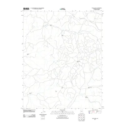
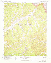
2011 Map of Yucca Hill
USGS Topo · Published 2011About this map
Yucca Hill stands as a central topographic landmark in this high-desert portion of the Navajo Nation during the early 21st century. The landscape is characterized by a series of named depressions and drainages, including Red Peak Valley and Dugout Valley, which channel water into ephemeral systems like Yucca Flat Wash and Forest Lake Wash. The influence of regional industry is evident in the northern reaches of the map, where the Peabody Coal Access Rd cuts through the terrain near Reed Valley. Local transportation is further defined by Main Rd and Indian Rte 8039, providing a record of the modern infrastructure and land use patterns within the Chinle Agency. The specific naming of Resting Cattle Valley and White House Valley provides a glimpse into the localized geography used by residents of Arizona and Navajo counties.
Find a feature on this map
12 named features on this map. Tap any name to fly to it.
Don’t see what you’re looking for? This feature index may not catch every label — zoom into the map to look around manually.
Map Details
Editions of this 2011 Yucca Hill Map
This is the sole edition of this map. No revisions or reprints were ever made.
Other maps of this area

1883 · Marsh Pass
USGS Topo · 1:250,000

1892 · Marsh Pass
USGS Topo · 1:250,000

1956 · Marble Canyon
USGS Topo · 1:250,000

1959 · Marble Canyon
USGS Topo · 1:250,000

1961 · Marble Canyon
USGS Topo · 1:250,000
1968 · Owl Valley
USGS Topo · 1:24,000
1968 · Toh Ne Zhonnie Spring
USGS Topo · 1:24,000
1968 · Owl Spring
USGS Topo · 1:24,000

1968 · Yucca Hill
USGS Topo · 1:24,000
1968 · Cliff Rose Hill
USGS Topo · 1:24,000