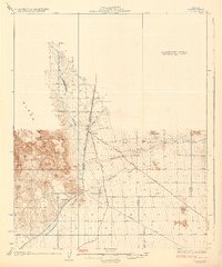
1929 Map of Yucca
USGS Topo · Published 1929About this map
Yucca serves as a critical junction in this arid Mohave County landscape, situated where the Atchison Topeka and Santa Fe Railway meets the historic Old Trails Highway. This 1920s-era survey captures the infrastructure of the high desert before the modernization of the interstate system, showcasing a network of secondary desert routes like the Signal Road, Lebarron Road, and the Yucca Cutoff.
Find a feature on this map
15 named features on this map. Tap any name to fly to it.
Don’t see what you’re looking for? This feature index may not catch every label — zoom into the map to look around manually.
Map Details
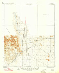
Editions of this 1929 Yucca Map
3 editions found

Other maps of this area

1886 · Diamond Creek
USGS Topo · 1:250,000

1886 · Camp Mohave
USGS Topo · 1:250,000

1892 · Diamond Creek
USGS Topo · 1:250,000

1892 · Camp Mohave
USGS Topo · 1:250,000

1903 · Needles
USGS Topo · 1:125,000

1904 · Needles Special
USGS Topo · 1:125,000

1923 · Signal
USGS Topo · 1:250,000

1927 · Yucca
USGS Topo · 1:62,500

1927 · Buck Mountains
USGS Topo · 1:62,500

1929 · Buck Mountains
USGS Topo · 1:62,500