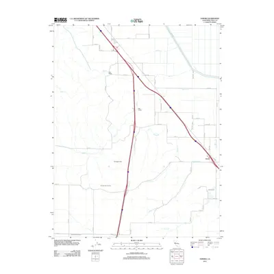
2012 Map of Zamora
USGS Topo · Published 2012About this map
Zamora serves as the primary community hub for this agricultural landscape in the Central Valley, defined by its extensive water infrastructure and gas extraction. The Colusa Basin Drainage Canal and the Tehama-Colusa Canal dominate the eastern and western portions of the quadrangle, illustrating the complex irrigation and drainage systems necessary for regional farming. The Dunnigan Hills rise to the west, hosting the Dunnigan Hills Gas Field, which points to the area's subterranean industrial value beyond surface-level cultivation. Local geography is further defined by seasonal drainage patterns including Bird Cr, Oat Cr, and Willow Spring Cr, while the Po in Zamora marks the historic center for local commerce and mail. This 2012 survey shows the grid of county roads, such as Co RD 14 and Co RD 88, that connect the valleys and hill country.
Find a feature on this map
52 named features on this map. Tap any name to fly to it.
Don’t see what you’re looking for? This feature index may not catch every label — zoom into the map to look around manually.
Map Details
Editions of this 2012 Zamora Map
This is the sole edition of this map. No revisions or reprints were ever made.
Other maps of this area

1905 · Harrington
USGS Topo · 1:24,000

1905 · Esparto
USGS Topo · 1:24,000

1907 · Dunnigan
USGS Topo · 1:62,500

1907 · Woodland
USGS Topo · 1:62,500

1915 · Yolo
USGS Topo · 1:31,680

1915 · Ronda
USGS Topo · 1:31,680
1915 · Kirkville
USGS Topo · 1:31,680

1916 · Jacobs Corner
USGS Topo · 1:31,680

1916 · Harrington
USGS Topo · 1:31,680

1916 · Hershey
USGS Topo · 1:31,680