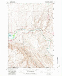
1964 Map of Zangar Junction
USGS Topo · Published 1983About this map
Zangar Junction serves as a critical rail intersection where the Northern Pacific and Union Pacific lines converge along the southern bank of the Walla Walla River. This mid-century survey captures the borderlands between Washington and Oregon, showing the confluence of heavy transport infrastructure and the natural hydrological features of the region. The map documents the eastern reach of Lake Wallula, a reservoir created behind the McNary Dam, which significantly altered the local landscape.
Find a feature on this map
18 named features on this map. Tap any name to fly to it.
Don’t see what you’re looking for? This feature index may not catch every label — zoom into the map to look around manually.
Map Details
Editions of this 1964 Zangar Junction Map
Other maps of this area

1915 · Wallulah
USGS Topo · 1:96,000

1918 · Wallula
USGS Topo · 1:125,000

1935 · Pendleton
USGS Topo · 1:125,000

1953 · Pendleton
USGS Topo · 1:250,000

1953 · Walla Walla
USGS Topo · 1:250,000

1956 · Pendleton
USGS Topo · 1:250,000

1958 · Walla Walla
USGS Topo · 1:250,000

1964 · Wallula
USGS Topo · 1:24,000

1964 · Zangar Junction
USGS Topo · 1:24,000

1964 · Slater
USGS Topo · 1:24,000