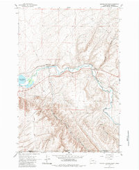
1964 Map of Zangar Junction
USGS Topo · Published 1984About this map
The Walla Walla River winds through a landscape defined by the intersection of state borders and critical transport infrastructure in the mid-1960s. Along the river’s north bank, the Union Northern Pacific rail line connects small settlements like Zangar Junction and Reese, while the southern hills are marked by the deep cuts of Vansycle Canyon and Ninemile Canyon. This area serves as a transition point between the higher elevations of Umatilla Co in Oregon and the river valley of Walla Walla Co in Washington. The presence of Lake Wallula at a normal pool elevation of 340 feet illustrates the managed hydrology of the region, while landmarks like Warm Springs and the Northern Trail provide evidence of the older routes and natural resources that influenced early settlement and movement through this cross-border corridor.
Find a feature on this map
20 named features on this map. Tap any name to fly to it.
Don’t see what you’re looking for? This feature index may not catch every label — zoom into the map to look around manually.
Map Details
Editions of this 1964 Zangar Junction Map
Other maps of this area

1915 · Wallulah
USGS Topo · 1:96,000

1918 · Wallula
USGS Topo · 1:125,000

1935 · Pendleton
USGS Topo · 1:125,000

1953 · Pendleton
USGS Topo · 1:250,000

1953 · Walla Walla
USGS Topo · 1:250,000

1956 · Pendleton
USGS Topo · 1:250,000

1958 · Walla Walla
USGS Topo · 1:250,000

1964 · Wallula
USGS Topo · 1:24,000

1964 · Zangar Junction
USGS Topo · 1:24,000

1964 · Slater
USGS Topo · 1:24,000