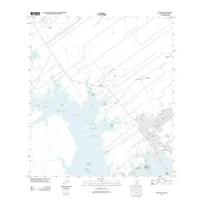
2012 Map of Zapata
USGS Topo · Published 2012About this map
Zapata and its surrounding communities are defined by their relationship to the shoreline of the Falcon Reservoir, which dominates the western half of this landscape. The town site is laid out in a grid including Lincoln St and Kennedy St, while developments like Falcon Shores and Linda Vista cluster near the water's edge. This 2012 survey illustrates the modern borderlands geography, where the reservoir covers former land tracts, leaving remnants such as Old Uribano and Arroyo San Bartolo along the rugged inlets.
Find a feature on this map
77 named features on this map. Tap any name to fly to it.
Don’t see what you’re looking for? This feature index may not catch every label — zoom into the map to look around manually.
Map Details
Editions of this 2012 Zapata Map
This is the sole edition of this map. No revisions or reprints were ever made.
Other maps of this area

1940 · Mogotes Hill
USGS Topo · 1:62,500

1942 · San Ygnacio
USGS Topo · 1:62,500

1949 · Mc Allen
USGS Topo · 1:250,000

1954 · McAllen
USGS Topo · 1:250,000

1956 · Mogotes Hill
USGS Topo · 1:62,500

1956 · Zapata
USGS Topo · 1:62,500

1956 · Arroyo Clareno
USGS Topo · 1:62,500

1956 · Laredo
USGS Topo · 1:250,000

1957 · Mc Allen
USGS Topo · 1:250,000

1962 · McAllen
USGS Topo · 1:250,000
Featured Places
- Zapata, TX
- Cuellar Colonia, TX
- Falcon Estates Colonia, TX
- Falcon Shores, TX
- Manuel Medina Addition Colonia, TX