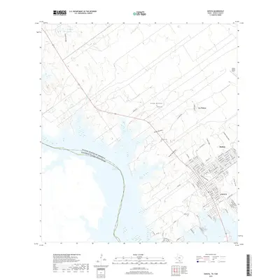
2019 Map of Zapata
USGS Topo · Published 2019About this map
The international boundary between the United States and Mexico runs through the center of the Falcon Reservoir, defining the western edge of this South Texas landscape. The town of Zapata serves as the primary hub, organized on a grid south of Arroyo Valeriano and extending toward the waterfront near Oscars Cove. Several smaller settlements like Las Palmas and Medina are situated inland, connected by a network of rural routes such as Mendoza Rd and Las Palmas Dr.
Find a feature on this map
96 named features on this map. Tap any name to fly to it.
Don’t see what you’re looking for? This feature index may not catch every label — zoom into the map to look around manually.
Map Details
Editions of this 2019 Zapata Map
This is the sole edition of this map. No revisions or reprints were ever made.
Other maps of this area

1940 · Mogotes Hill
USGS Topo · 1:62,500

1942 · San Ygnacio
USGS Topo · 1:62,500

1949 · Mc Allen
USGS Topo · 1:250,000

1954 · McAllen
USGS Topo · 1:250,000

1956 · Mogotes Hill
USGS Topo · 1:62,500

1956 · Zapata
USGS Topo · 1:62,500

1956 · Arroyo Clareno
USGS Topo · 1:62,500

1956 · Laredo
USGS Topo · 1:250,000

1957 · Mc Allen
USGS Topo · 1:250,000

1962 · McAllen
USGS Topo · 1:250,000
Featured Places
- Zapata, TX
- Cuellar Colonia, TX
- Falcon Estates Colonia, TX
- Falcon Shores, TX
- Manuel Medina Addition Colonia, TX