2022 Map of Zapata
USGS Topo · Published 2022About this map
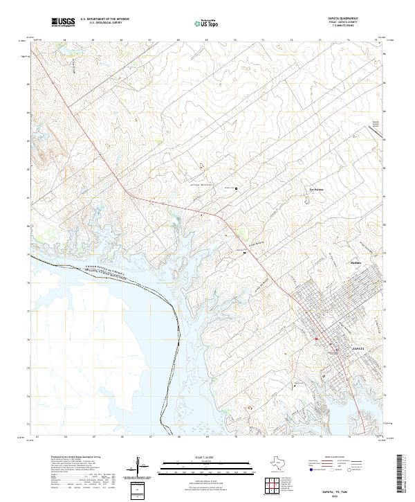
The Rio Grande marks the international boundary between the United States and Mexico along this stretch of the South Texas border. The landscape is defined by the expansive Falcon Reservoir, which has reshaped the local drainage patterns of numerous seasonal watercourses, including Arroyo Molletes and Chapote Cr. The community of Zapata serves as the central hub, organized around the Zapata County Courthouse and a grid of streets that extend toward the lake shore. Nearby settlements such as Medina and Las Palmas are situated along the elevated terrain above the arroyos. Historical sites for researchers include the Zapata Cem, Ranchito Cem, and Uribeno Cem, while the Zapata County Airport facilitates regional access. The map reveals the intricate network of residential streets and local connectors, including Mendoza Rd and Las Palmas Dr, that navigate the undulating terrain near the reservoir's edge.
Find a feature on this map
100 named features on this map. Tap any name to fly to it.
Don’t see what you’re looking for? This feature index may not catch every label — zoom into the map to look around manually.
Map Details
Editions of this 2022 Zapata Map
This is the sole edition of this map. No revisions or reprints were ever made.
Historical Maps of Flores Addition Colonia Through Time
4 maps found