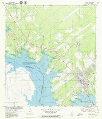
1979 Map of Zapata
USGS Topo · Published 1979About this map
Falcon Reservoir, known south of the border as Presa Falcón, dominates this borderland landscape where the Rio Grande marks the international boundary between Texas and Tamaulipas. The settlement of Zapata is shown in detail, oriented along the reservoir's eastern shore with its High Sch, Zapata Cemetery, and local infrastructure including a Drive-in Theater and Sewage Disposal plant.
Find a feature on this map
34 named features on this map. Tap any name to fly to it.
Don’t see what you’re looking for? This feature index may not catch every label — zoom into the map to look around manually.
Map Details
Editions of this 1979 Zapata Map
This is the sole edition of this map. No revisions or reprints were ever made.
Other maps of this area

1940 · Mogotes Hill
USGS Topo · 1:62,500

1942 · San Ygnacio
USGS Topo · 1:62,500

1949 · Mc Allen
USGS Topo · 1:250,000

1954 · McAllen
USGS Topo · 1:250,000

1956 · Mogotes Hill
USGS Topo · 1:62,500

1956 · Zapata
USGS Topo · 1:62,500

1956 · Arroyo Clareno
USGS Topo · 1:62,500

1956 · Laredo
USGS Topo · 1:250,000

1957 · Mc Allen
USGS Topo · 1:250,000

1962 · McAllen
USGS Topo · 1:250,000