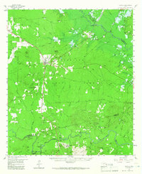
1958 Map of Zavalla
USGS Topo · Published 1966About this map
The Angelina National Forest dominates this East Texas landscape, where the Texas and New Orleans Railroad serves as a primary corridor through the timberlands. The settlement of Zavalla stands as the central hub, supported by smaller locales such as Dolan and Martin. To the south, the Neches River forms a natural boundary near Rockland, notable for the Historical Monument marking the site of Fort Teran. This area is characterized by a dense network of creek systems including Harvey Creek and Caney Creek, alongside legacy features like the Old Railroad Grade. Local life is anchored by family-named landmarks and rural institutions, from the Sulphur Springs Ch to the Vernon Sch and numerous community burial grounds like Townsend Cem. Industrial traces such as the Barium Mill and various Gravel Pits reflect the region's resource-based economy during the mid-20th century.
Find a feature on this map
92 named features on this map. Tap any name to fly to it.
Don’t see what you’re looking for? This feature index may not catch every label — zoom into the map to look around manually.
Map Details
Editions of this 1958 Zavalla Map
3 editions found

Other maps of this area

1928 · Zavalla 3-c
USGS Topo · 1:24,000

1928 · Lufkin 4-d
USGS Topo · 1:24,000

1931 · Zavalla
USGS Topo · 1:62,500

1932 · Manning
USGS Topo · 1:62,500

1949 · Lufkin
USGS Topo · 1:62,500

1949 · Huntington
USGS Topo · 1:24,000

1950 · Huntington
USGS Topo · 1:24,000

1953 · Palestine
USGS Topo · 1:250,000

1954 · Beaumont
USGS Topo · 1:250,000

1955 · Woodville
USGS Topo · 1:62,500