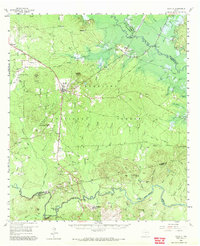
1958 Map of Zavalla
USGS Topo · Published 1972About this map
The Angelina National Forest dominates the landscape of this East Texas survey, where the Angelina River and Neches River frame a region defined by its timber and river-bottom topography. The settlement of Zavalla sits as a central hub along the Texas and New Orleans railroad line, which served as a primary transportation artery through the piney woods. To the south, along the banks of the Neches, the map identifies the Historical Monument (Site of Fort Teran), marking the location of an early 19th-century military outpost.
Find a feature on this map
84 named features on this map. Tap any name to fly to it.
Don’t see what you’re looking for? This feature index may not catch every label — zoom into the map to look around manually.
Map Details
Editions of this 1958 Zavalla Map
3 editions found

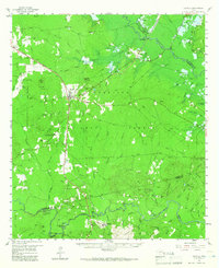
Other maps of this area

1928 · Zavalla 3-c
USGS Topo · 1:24,000

1928 · Lufkin 4-d
USGS Topo · 1:24,000

1931 · Zavalla
USGS Topo · 1:62,500

1932 · Manning
USGS Topo · 1:62,500

1949 · Lufkin
USGS Topo · 1:62,500

1949 · Huntington
USGS Topo · 1:24,000

1950 · Huntington
USGS Topo · 1:24,000

1953 · Palestine
USGS Topo · 1:250,000

1954 · Beaumont
USGS Topo · 1:250,000

1955 · Woodville
USGS Topo · 1:62,500