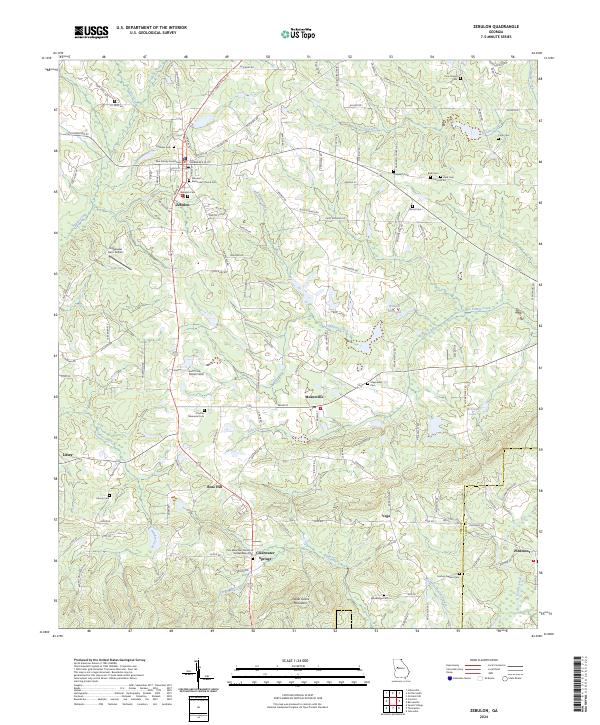
2024 Map of Zebulon
USGS Topo · Published 2024About this map
Pike County Courthouse serves as the focal point of Zebulon, the seat of a landscape where small Piedmont settlements are knit together by a dense network of county roads. The terrain is defined by the high ground of Indian Grave Mountain to the south and a series of westward-flowing tributaries including Threemile Creek and Hardin Creek. The geography reveals a long-standing rural community structure, with numerous family and church burial grounds such as Nazareth Cem, Wood Cem, and Century Nelson Cem scattered across the countryside.
Find a feature on this map
127 named features on this map. Tap any name to fly to it.
Don’t see what you’re looking for? This feature index may not catch every label — zoom into the map to look around manually.
Map Details
Editions of this 2024 Zebulon Map
This is the sole edition of this map. No revisions or reprints were ever made.
Other maps of this area

1935 · Thomaston
USGS Topo · 1:48,000

1939 · Thomaston
USGS Topo · 1:62,500

1951 · Yatesville
USGS Topo · 1:62,500

1951 · Barnesville
USGS Topo · 1:62,500

1953 · Atlanta
USGS Topo · 1:250,000

1955 · Phenix City
USGS Topo · 1:250,000

1957 · Phenix City
USGS Topo · 1:250,000

1957 · Atlanta
USGS Topo · 1:250,000

1958 · Phenix City
USGS Topo · 1:250,000

1958 · Atlanta
USGS Topo · 1:250,000