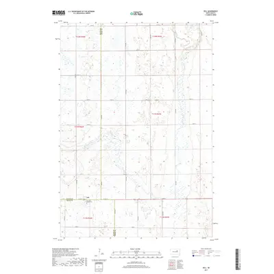
2017 Map of Zell
USGS Topo · Published 2017About this map
The small unincorporated community of Zell occupies a quiet section of the South Dakota prairie where the borders of Faulk, Hand, and Spink counties meet. This 2017 topographic record reflects a landscape defined by expansive agricultural sections and the wandering drainage of Dove Creek, which winds its way across the central and southern portions of the quadrangle. Northward, the waters of S Fork Snake Cr cross the upper boundary, illustrating the subtle hydrology of this glaciated terrain.
Find a feature on this map
31 named features on this map. Tap any name to fly to it.
Don’t see what you’re looking for? This feature index may not catch every label — zoom into the map to look around manually.
Map Details
Editions of this 2017 Zell Map
This is the sole edition of this map. No revisions or reprints were ever made.
Other maps of this area

1899 · Northville
USGS Topo · 1:125,000

1899 · Redfield
USGS Topo · 1:125,000

1953 · Redfield North
USGS Topo · 1:24,000

1953 · Huron
USGS Topo · 1:250,000

1954 · Aberdeen
USGS Topo · 1:250,000

1954 · Huron
USGS Topo · 1:250,000

1956 · Aberdeen
USGS Topo · 1:250,000
1960 · Athol
USGS Topo · 1:24,000

1966 · Cresbard SE
USGS Topo · 1:24,000
1966 · Northville SW
USGS Topo · 1:24,000