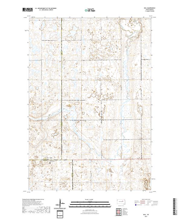
2021 Map of Zell
USGS Topo · Published 2021About this map
Zell sits at the meeting point of Faulk, Hand, and Spink counties in this 2021 landscape. The settlement is anchored by Saint Marys Catholic Cem, serving as a central point for the surrounding agricultural prairie. The terrain is defined by a dense network of intermittent wetlands and the meandering course of Dove Creek, which flows through the center of the quadrangle. To the northeast, the South Fork Snake Creek (also labeled as S Fork Snake Cr) cuts across the corner of the survey. The geography reflects the rigid grid of the Public Land Survey System, with roads like 375th Ave and 172nd St following section lines through the township and range divisions of T117N and T116N.
Find a feature on this map
32 named features on this map. Tap any name to fly to it.
Don’t see what you’re looking for? This feature index may not catch every label — zoom into the map to look around manually.
Map Details
Editions of this 2021 Zell Map
This is the sole edition of this map. No revisions or reprints were ever made.
Other maps of this area

1899 · Northville
USGS Topo · 1:125,000

1899 · Redfield
USGS Topo · 1:125,000

1953 · Redfield North
USGS Topo · 1:24,000

1953 · Huron
USGS Topo · 1:250,000

1954 · Aberdeen
USGS Topo · 1:250,000

1954 · Huron
USGS Topo · 1:250,000

1956 · Aberdeen
USGS Topo · 1:250,000
1960 · Athol
USGS Topo · 1:24,000

1966 · Cresbard SE
USGS Topo · 1:24,000
1966 · Northville SW
USGS Topo · 1:24,000