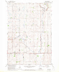
1966 Map of Zell
USGS Topo · Published 1967About this map
The small settlement of Zell anchors this mid-century survey, situated at the convergence of three counties: Faulk, Spink, and Hand. This agricultural landscape is defined by the Chicago and North Western railroad line, which runs parallel to Route 212 through the southern portion of the quadrangle. The terrain is marked by township-sized tracts such as Pioneer, Athol, and Groveland, suggesting a rural structure rooted in early land divisions.
Find a feature on this map
16 named features on this map. Tap any name to fly to it.
Don’t see what you’re looking for? This feature index may not catch every label — zoom into the map to look around manually.
Map Details
Editions of this 1966 Zell Map
This is the sole edition of this map. No revisions or reprints were ever made.
Other maps of this area

1899 · Northville
USGS Topo · 1:125,000

1899 · Redfield
USGS Topo · 1:125,000

1953 · Redfield North
USGS Topo · 1:24,000

1953 · Huron
USGS Topo · 1:250,000

1954 · Aberdeen
USGS Topo · 1:250,000

1954 · Huron
USGS Topo · 1:250,000

1956 · Aberdeen
USGS Topo · 1:250,000
1960 · Athol
USGS Topo · 1:24,000

1966 · Cresbard SE
USGS Topo · 1:24,000
1966 · Northville SW
USGS Topo · 1:24,000