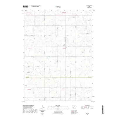
2018 Map of Zion
USGS Topo · Published 2018About this map
Zion stands at the center of this rural landscape where the rolling uplands of Adair and Union counties meet. The settlement is anchored by the Hill of Zion Cem, reflecting a long-standing community presence along Co HWY g61. To the west, the village of Spaulding lies near the headwaters of Twentymile Cr, illustrating the typical midwestern pattern of small agricultural centers positioned at intervals along county roads.
Find a feature on this map
50 named features on this map. Tap any name to fly to it.
Don’t see what you’re looking for? This feature index may not catch every label — zoom into the map to look around manually.
Map Details
Editions of this 2018 Zion Map
This is the sole edition of this map. No revisions or reprints were ever made.
Other maps of this area

1951 · Afton
USGS Topo · 1:62,500

1952 · Winterset
USGS Topo · 1:62,500

1954 · Greenfield
USGS Topo · 1:62,500

1954 · Omaha
USGS Topo · 1:250,000

1957 · Omaha
USGS Topo · 1:250,000

1958 · Omaha
USGS Topo · 1:250,000

1980 · Creston East
USGS Topo · 1:24,000

1981 · Zion
USGS Topo · 1:24,000
1981 · Orient
USGS Topo · 1:24,000
1981 · Creston West
USGS Topo · 1:24,000