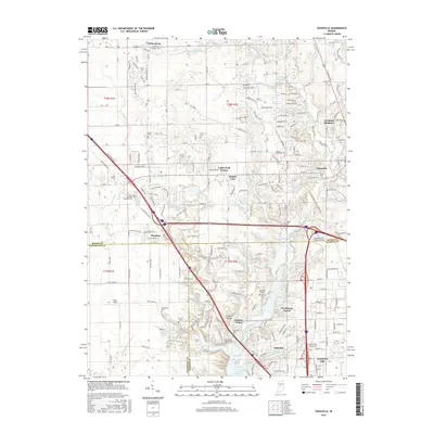
2016 Map of Zionsville
USGS Topo · Published 2016About this map
The town of Zionsville and the northern reaches of Indianapolis define this modern era landscape, where rapid residential development meets established rural heritage. The map details a complex transition zone where suburban neighborhoods like Northern Meadows and Legendary Hills spread toward historic farming settlements. Numerous small family and community burial grounds, including the Macedonia Cem and Pitzer Cem, remain as quiet witnesses to the area's agricultural past amid expanding infrastructure.
Find a feature on this map
223 named features on this map. Tap any name to fly to it.
Don’t see what you’re looking for? This feature index may not catch every label — zoom into the map to look around manually.
Map Details
Editions of this 2016 Zionsville Map
This is the sole edition of this map. No revisions or reprints were ever made.
Other maps of this area

1948 · Indianapolis West
USGS Topo · 1:24,000

1952 · Carmel
USGS Topo · 1:24,000

1953 · Westfield
USGS Topo · 1:24,000

1953 · Fayette
USGS Topo · 1:24,000

1953 · Rosston
USGS Topo · 1:24,000

1953 · Brownsburg
USGS Topo · 1:24,000

1953 · Zionsville
USGS Topo · 1:24,000

1953 · Lebanon
USGS Topo · 1:24,000

1953 · Clermont
USGS Topo · 1:24,000

1953 · Danville
USGS Topo · 1:250,000
Featured Places
- Indianapolis, IN
- Zionsville, IN
- Whitestown, IN
- Legendary Hills, Indianapolis
- Traders Point, Indianapolis