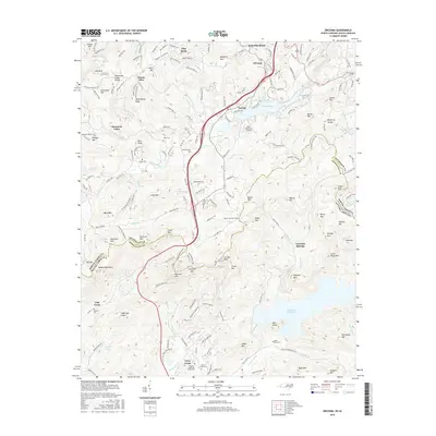
2016 Map of Zirconia
USGS Topo · Published 2016About this map
Lake Summit and the Green River anchor the upper portion of this survey, where the rugged topography of the Saluda Mountains marks the boundary between North and South Carolina. This high-elevation terrain is defined by numerous peaks such as McAlpine Mtn and Panther Mtn, while the Tennessee Valley Divide snakes through the northwestern corner. The settlement pattern shows a concentration of small communities like Zirconia, Tuxedo, and Flat Rock, often centered around these mountain watercourses.
Find a feature on this map
188 named features on this map. Tap any name to fly to it.
Don’t see what you’re looking for? This feature index may not catch every label — zoom into the map to look around manually.
Map Details
Editions of this 2016 Zirconia Map
This is the sole edition of this map. No revisions or reprints were ever made.
Other maps of this area

1905 · Pisgah
USGS Topo · 1:125,000

1906 · Pisgah
USGS Topo · 1:125,000

1907 · Saluda
USGS Topo · 1:125,000

1935 · Standingstone Mtn.
USGS Topo · 1:24,000

1935 · Horse Shoe
USGS Topo · 1:24,000

1935 · Hendersonville
USGS Topo · 1:24,000

1935 · Fishtop
USGS Topo · 1:24,000

1935 · Zirconia
USGS Topo · 1:24,000
1942 · Horse Shoe
USGS Topo · 1:24,000
1946 · Standingstone Mtn.
USGS Topo · 1:24,000