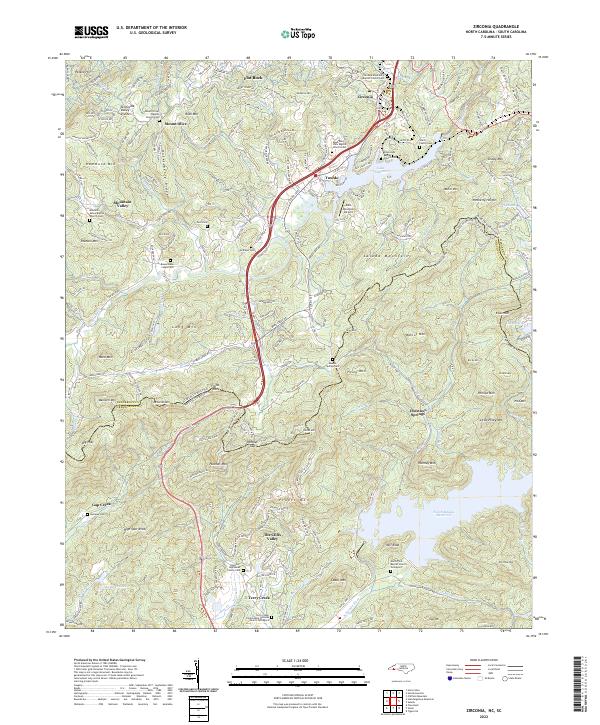
2022 Map of Zirconia
USGS Topo · Published 2022About this map
Saluda Mountains dominate this rugged terrain on the border of North and South Carolina, where the Green River carves through the landscape to feed Lake Summit. This region is characterized by small, dispersed settlements like Tuxedo, Zirconia, and Flat Rock, each anchored by community landmarks such as the Zirconia Missionary Baptist Church Cem and Crossroads Baptist Church Cem. The topography is a complex network of high peaks and ridges, including Panther Mtn and McCarrol Mtn, which define the drainage basins for features like the North Saluda Reservoir. Genealogists will find a wealth of local history in the numerous small family and church burial grounds scattered across the valleys, from the Ward Family Cem to the Hagood Hightower Family Cem, illustrating the deep-rooted settlement patterns of these mountain communities.
Find a feature on this map
126 named features on this map. Tap any name to fly to it.
Don’t see what you’re looking for? This feature index may not catch every label — zoom into the map to look around manually.
Map Details
Editions of this 2022 Zirconia Map
This is the sole edition of this map. No revisions or reprints were ever made.
Other maps of this area

1905 · Pisgah
USGS Topo · 1:125,000

1906 · Pisgah
USGS Topo · 1:125,000

1907 · Saluda
USGS Topo · 1:125,000

1935 · Standingstone Mtn.
USGS Topo · 1:24,000

1935 · Horse Shoe
USGS Topo · 1:24,000

1935 · Hendersonville
USGS Topo · 1:24,000

1935 · Fishtop
USGS Topo · 1:24,000

1935 · Zirconia
USGS Topo · 1:24,000
1942 · Horse Shoe
USGS Topo · 1:24,000
1946 · Standingstone Mtn.
USGS Topo · 1:24,000